

Don't get left behind...
See what we've done for others.


Dronue' Key Services
See your site exactly as it is—clear, accurate, and ready to share. Alongside aerial photography and videography, we capture every angle with stunning detail—giving you the clearest view of your site, anywhere, anytime.

Drone 3D Site Scans
Turn reality into digital reality with Dronue and copy and paste your site onto your screen! Immersive 3D Reality Capture visual site scans that offer a detailed and accurate representation of real world environments.

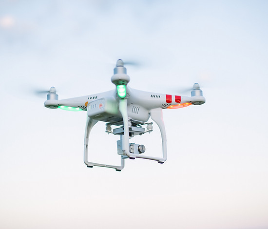
Drone Shots
Elevate your projects with our drone photography and videography services. From breathtaking aerial views to dynamic video footage, we bring a fresh and dynamic dimension to your visuals.

Custom Solutions
Tailored to meet your specific needs, our services offer custom solutions for aerial photography and videography projects. Let us bring your vision to life with creativity and expertise.
What's in it for you?
Drone surveying offers countless advantages, but these are some that stand out.

The go to for Drone 3D site models
Here are some of our deliverables!
Reality Capture Interactive Web-based Model
BIM 3D Model File in various file formats (OBJ, PLY, B3DM etc.)
Point Cloud File in various file formats (LAS, PLY etc.)
Detailed Images capturing your entire site
4k Cinematic Video Clips

DTM & DEM
Marketing & PR Photography & Videography
We capture your site in it's best light—literally. Our photography and videography service comes standard with every 3D survey, but if you just need stunning visuals, this can be provided as a separate service.

Instant access to every external site detail, exactly when you need it.
Virtually view and inspect your property/project like never before with our interactive, web-based viewer. Explore every corner of your site in stunning detail, all from the comfort of your chair. Make smarter, informed decisions that can save you time, reduce costs, and unlock new opportunities for profit & growth.
Accurate Data Matters
The model can be captured with exceptional accuracy, powered by advanced photogrammetry and RTK technology. Every measurement you take is highly reliable, allowing you to inspect with total confidence. Measure elements with pinpoint precision, from structural heights to ground distances and every detail in between. Plus, all measurements can be easily exported for your records or design workflow, ensuring that you have precise data ready when you need it.

Countless aerial images,
just a click away
Explore every inch of your site in stunning clarity with the amazing photo inspection tool. Just one click gives you instant access to high-resolution, geotagged images, exactly where you need them. Whether you’re zooming in on specific site details or reviewing the entire area, our immersive photos provide a complete visual experience that brings your project to life. See every angle, inspect every element, and make confident decisions without ever stepping foot on-site.

Contact us for a Quotation!
We can’t wait to work with you! To make sure we’re a great fit, we’d love to learn more about your site and what you’re looking for. Shoot us an email now, and we’ll get you a personalised quote right away! To help us nail it, please try include the following details.
Site Location
Site Boundary (e.g. /Site Plan Drawing)
Potential Restrictions (e.g. Site Access, Occupants etc.


About Dronue
Boasting a legacy in surveying, principal design, and stringent Health & Safety protocols, Dronue presents an unmissable service package at an exceptional price. Combining extensive experience in these areas, we deliver unparalleled precision, innovative design solutions, and a safety-focused approach that underscores our dedication to exceeding expectations.
Experience in Surveying, Principal Design, and Health & Safety brought to new heights.
Advanced Drone Surveys with a twist
01
Accurate survey positions
02
Thousands of geotagged images
Survey grade GNSS receivers are used to obtain accurate positional data for various ground control points within your site, allowing highly precise data to be used for photogrammetry & accurate measurements throughout the site.
Dronue soars through the skies, capturing thousands of high-definition close up images of your site. All whilst connected to a GNSS receiver with an external NTRIP RTK correction service. This setup ensures pinpoint georeferenced images, capturing every angle, crevasse, and imaginable detail all to incredible scale and accuracy.
04
03
Post-processing Magic
Delivery made simple
After we obtain our positional data and high definition images, those are all post processed. Thousands of images stitched together to form a variety of deliverables, aligned and georeferenced for survey grade 1cm level accuracy. Work of magic!
We pride ourselves with being able to offer your reality captured site through a simple live link, allowing your to view your virtual site on a webbased 3D platform. Share the link to anyone you please, show off your model and collabrate with ease. This is just one of our deliverables, see below for more deliverable information.
Whether you're looking to obtain a new property, or simply maintain your existing portfolio, Dronue does it all. Ideal for the pre-construction phase for enhanced site visualisation and collaboration, ideal for construction phase and progress/quality monitoring, and ideal for post construction, management and maintenance of existing buildings. Ideal for everything...
Have any questions? Send us an email to contact@dronue.com
_edited.png)


